List of External Links
- McKenzie River Trail Map
Shows the whole trail well - MRT Shuttle
A Local MRT Shuttle - Finn Rock Grill - Vida, OR
Great Place to eat - MRT Shuttle with Cog Wild
An alternative shuttle company - Mountain Biking North Western Mountains and Valleys
Kelly's Cool MTB Web Site - The Whole MRT by theleeman at Garmin Connect - Details
Garmin view of my ride - McKenzie River Vacation Cabins
Great place to stay
The McKenzie River Trail is one of the best trails in Oregon, if not one of the best trails around. It has some amazing sights, including several water falls, a pool of water so blue its Azure, an underground river, and miles of fairly technical trail that pass through lava beds, where the trail seems hewn directly out of stone.
Check out pictures from this ride, here. See below for Ride Data.
Ride Preparation
We chose to shuttle the MRT, giving us the opportunity to ride the whole thing. We used the McKenzie River Mountain Resort Shuttle. I hear Cog Wild has one too, but the Cog Wild Shuttle is focused on folks out of Bend. We picked a 10 AM Shuttle start time, because we thought we would be driving to the Trail Head first thing in the morning, and that's about a 3-hour drive!
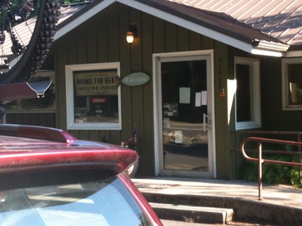
Common sense (and a semi-hard sell from the Resort) talked us into renting a Cabin, so 3 of us planned to live in luxury for the one evening and morning we'd be there. It was a really nice cabin!
I got to the cabin first, in the afternoon, so I decided to check out the Finn Rock Grill, just a few miles from the resort. The view of the McKenzie River from the deck was amazing and refreshing.

The Ride, first Half: Techno Gonzo
If you take a shuttle, you don't have to worry about where the top of the trail is located. If you're on your own, it's a small parking area, on the right, just past NF-2676 (also on the right). It took us about 1/2 hour to ride up in the shuttle van. Luckily, as the trip organizer, I got to sit in the front seat -- I fear my friends where packed in like Sardines in the back, but we made it.
The temperate was nice when we got out -- it's a summer pleasure to be able to get out in the morning in shorts and short sleeves and not be cold. But we knew it would get hot, as it was already warm in the sun. Here is a picture of Bob Hornes, me, Kelley Hinkle, Barry DeSemple, Alex Sandrow, and Aaron Hendrick.

After we posed for some photos, the six of us crossed the bridge and headed down the trail.
I could tell from the start that Bob was a little agro (a biking term for aggressive). Turns out he was training for a 50-mile race in the Capital Forest. As we headed down the shaded tunnel of giant trees, Kelley and I hung back and enjoyed the ride, laughing at how fast the front guys were going. We both knew it would be a long day.
Good thing Kelley was paying attention, as he knew the trail best. We almost went the wrong way around the lake at the top. There's a technical side, and there's an easier side. Based on the rest of the trail we had decided to take the easy side (easy being relative), but we almost went the hard way. Good catch Kelley!
Partway Down: The Blue Pool
After 7.3 miles and an hour and twenty minutes, we reached the Blue Pool, but not before the front guys flew past Sahalie Falls. Kelley and I again laughed at how the other 4 folks had missed a beautiful site, and we vowed to stop at Blue Pool whether the fast guys noticed it or not. Turns out it is pretty hard to miss the Blue Pool, as the trail drifts within a foot of the cliff leading down to the falls.

As you can see, the pool is quite blue -- Azure, really! Wow. You might actually be able to see a white object under the water on the far side of the pool. We were told by a hiker that this white object was a diving slate where you could write your name, if you were brave enough to hike down to the lake (30+ minutes), swim across the icy water, then dive deep to get the slate. It was hot, but not that hot, so no thanks!
After refueling and visiting (surprising who you find at the Blue Pool), we decided to continue on, since we were only about 1/3 done with our ride: no rest for the wicked.
We continued on. The portion of the trail just below the Blue Pool is ultra technical. I do not have any pictures because I just wanted to make it through alive. A set of pads would have helped (good thinking, Kelley). We managed to make it (I walked more than one section) to the halfway point, Trail Bridge Reservoir. We knew we would be able to get water here, but it was a mixed blessing, as the water spigot was 1/4 mile off the trail and in the blazing (ridiculously hot) sun. I think they found the hottest spot in the valley and placed the water there. We managed to rehydrate and continue on, getting out of the direct baking sun.
The Bottom Half: Finishing a great ride …
After our water stop, we were getting tired, but we could see the goal lines, in our minds: beer after the ride!
Here's a video Kelley shot with his Contour video camera, starting at Blue Pool. (I'm in the video only at the very end, as Kelley rides up to the group.)
As we continued down, the group started to spread out a little more -- some of us were getting tired. Bob and Aaron seemed to be less tired than the rest and took the lead. I tried to keep up with Aaron and managed to do so part of the time. We were flying. I had to dodge trees close to the trail -- I've received a love tap from trees while flying down the trail before, and it's not pleasant.
Near the end, Kelley, Barry, and Bob wanted to peel off at Belknap Hot Springs, where they were camping, but Bob and Barry missed the turn. Barry realized it, but Bob decided to ride all the way to the end of the trail then back to the campgrounds -- an extra 8 miles! Somebody needs to tie an anchor to that guy.
Ride Data
- Ride Type: Shuttle or O&B
- Ride Length: 25 Miles (one way)
- Ascent: About 900 Ft.
- Descent: About 2600 ft
- Ride Time: 4-5 Hours
- Technical Difficulty: Intermediate, advanced in places
- Plus: Very Scenic, fun ride
- Minus: Crowded in spots
- Location: E of Springfield, OR
During this last section, Aaron and I made it to the cars first (not counting Bob), and we waited for Alex. We were worried, but he showed up a few minutes later, having helped a lady out on the trail that had brake problems.
All in all, it was an amazing day. The only bad part: Aaron, Alex, and I had to get in our cars and drive 3 hours to get home. I was worried I would get sleepy on the way home (I drove alone), but no such problem, as I was still wired from the ride.
If you want more information, check out the links at the top of this page, including one to Kelley's web site where he has a nice ride description of this same ride (link here), with more detail about the trail itself.
Alternatives
This trail can of course be ridden as an out and back, best done from near the bottom. It is common to either park at or near the Ranger Station at the bottom of the trail, or to park (and camp if you like) at the Hot Springs.
One could also make a loop the hard way, by parking at the bottom and riding up the road, but the Highway is rather narrow with many high-speed cars, so I'd advise against that, though it has been done.